Mont Blanc looms large in the imagination: at 4,808 metres it is the highest peak in Europe, its name synonymous with ropes, crampons, and seasoned alpinists. Yet much of this massif is fully accessible to any well-prepared hiker. Across the Mont-Blanc Country, dozens of waymarked trails let you get close to the summits without ever touching a rope. You do not need to be a mountaineer to walk in the shadow of the Chamonix Aiguilles.
Trail hiking versus alpine climbing: a key distinction
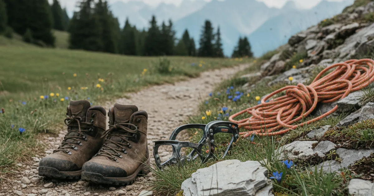
Alpine routes on Mont Blanc demand specific technical skills: movement on compact ice, use of an ice axe, crevasse awareness, reading glacial terrain. These itineraries represent a tiny fraction of what is actually accessible. Alongside them, a dense network of FFRP-waymarked trails covers hillsides, high pastures, and mountain passes. These paths are maintained, signed, and designed for standard footpath hiking.
The simple rule: a yellow or red-and-white waymarked trail is a hiking route, not a climbing line. In the Arve Valley, around Chamonix, hiking trails and technical routes often share the same trailheads and mountain huts but diverge quickly on the ground. Follow the waymarks, stay on the marked path, and you are on a hiking route.
The balcony trails: panoramas without the technical commitment
Balcony trails are the defining feature of the Chamonix sector. The Grand Balcon Sud traverses the mountain at mid-height along the eastern side of the valley, looking straight across to the great faces and glaciers. It links several intermediate stations and can be walked for hours with permanent views of the massif. The Grand Balcon Nord follows the very base of the Mont Blanc range, closer to the seracs and rock needles, at a higher elevation. Neither route requires technical skills, but both demand solid fitness: elevation gain accumulates and the terrain can be stony.
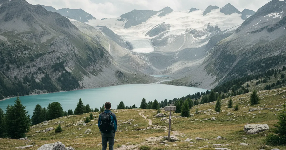
Lac Blanc at 2,352 m is the area's signature hike. Well-defined paths lead to it from La Flégère or from Argentière. The panorama of the Mont Blanc range from this high-altitude lake is among the finest in Haute-Savoie. Budget four to five hours return from the intermediate lifts. No mountaineering required, but the altitude demands an early start, warm layers, and close attention to the weather.
Val Montjoie: the quieter side of Mont-Blanc Country
A few kilometres south of Chamonix, the landscape changes character. Saint-Gervais-les-Bains and Les Contamines-Montjoie open onto the Val Montjoie, calmer and less crowded, yet every bit as spectacular. The Contamines-Montjoie nature reserve, the largest in Haute-Savoie, protects high-altitude wetlands, glaciers, and summer pastures. Chamois, ibex, and marmots are regular companions on the trail.
The Col de Voza (1,653 m) is one of the key waypoints on the Tour du Mont-Blanc and is fully reachable on a standard hiking day from Saint-Gervais or from Les Houches. The panorama from the top takes in the Bionnassay glaciers, the northern slopes of Mont Blanc, and the first Italian ridges. The little Mont Blanc train from Saint-Gervais makes access easy and saves climbing all the altitude on foot.
What you will see: glaciers, wildlife, and a changing landscape
Hiking in Mont-Blanc Country means walking alongside living glaciers. The Bossons Glacier, the Mer de Glace, the Bionnassay Glacier: you see them from the trail, sometimes only a few hundred metres away, without ever setting foot on ice. Interpretation panels on several routes document the historical positions of glacial fronts and their retreat over recent decades. It is a concrete lesson in physical geography, visible to the naked eye.
High-altitude wildlife is abundant. Alpine meadows around 2,000 m host marmot colonies active from spring through autumn. Ibex occupy the rocky slopes above. Look up at the ridgelines and you may spot a lammergeier soaring on a thermal: a massive bird with an unmistakable wingspan and a silhouette unlike anything else in the Alps.
Planning your day: season, gear, and getting there
A few practical points before you head out:
- The season runs from late June to early October, depending on snowfall. Before and after this window, high-altitude trails can carry compact, slippery snow.
- Summer afternoon thunderstorms are common. Start early and aim to be back in the valley before 2 pm on unsettled days.
- Temperature drops fast with altitude. Above 2,000 m, carry a waterproof shell, light gloves, and a fleece layer even in the height of summer.
- High-ankle boots with a rigid sole are recommended. Terrain is often stony with sections of stable scree.
- Carry 1.5 to 2 litres of water per person. Not all mountain springs are safe to drink untreated.
In peak season, car parks around Chamonix and Les Contamines fill up before 9 am. Shuttles from the valley and the Mont Blanc Express train (Saint-Gervais to Chamonix with intermediate stops) are often more practical than driving. Carpooling from Cluses or Sallanches is also worth considering.
Mont-Blanc Country is not reserved for alpinists. Its trails let you get within reach of glaciers, breathe the air above 2,000 metres, and take in landscapes that few places in Europe can match: no rope, no ice axe, no specialist training required. Choose your route with care, respect the mountain, and pick the right season. For more ideas, browse all the hiking trails of Haute-Savoie sorted by area and difficulty.